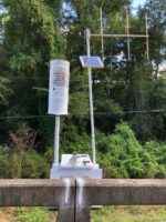
In 2022, with a help from a Wiregrass RC&D grant, the Flood Warning System (FWS)–operated and maintained by the CPYRWMA–received additional gauges. The FWS currently consists of 22 rain/river gauges located at strategic locations in eight southeastern Alabama counties that electronically monitor rainfall and river levels. This data is disseminated in real time to the National Weather Service (NWS) which uses the information to develop forecasts. This project provided a precipitation gauge in the watershed that drains to the Pea River and will help the NWS provide more accurate forecasts.
